April 22, 2026. On April 22, 2026, at the Scientific Seminar of the Geophysical Center RAS, PhD Alexey Sentsov, Senior Researcher at the Laboratory of Fundamental Problems of Environmental Geophysics and Volcanology of the Schmidt Institute of Physics of the Earth of the RAS, presented a report titled "Seismotectonics of Areas of Active Tectonogenesis Based on a New Methodological Approach" (based on materials from his doctoral dissertation).
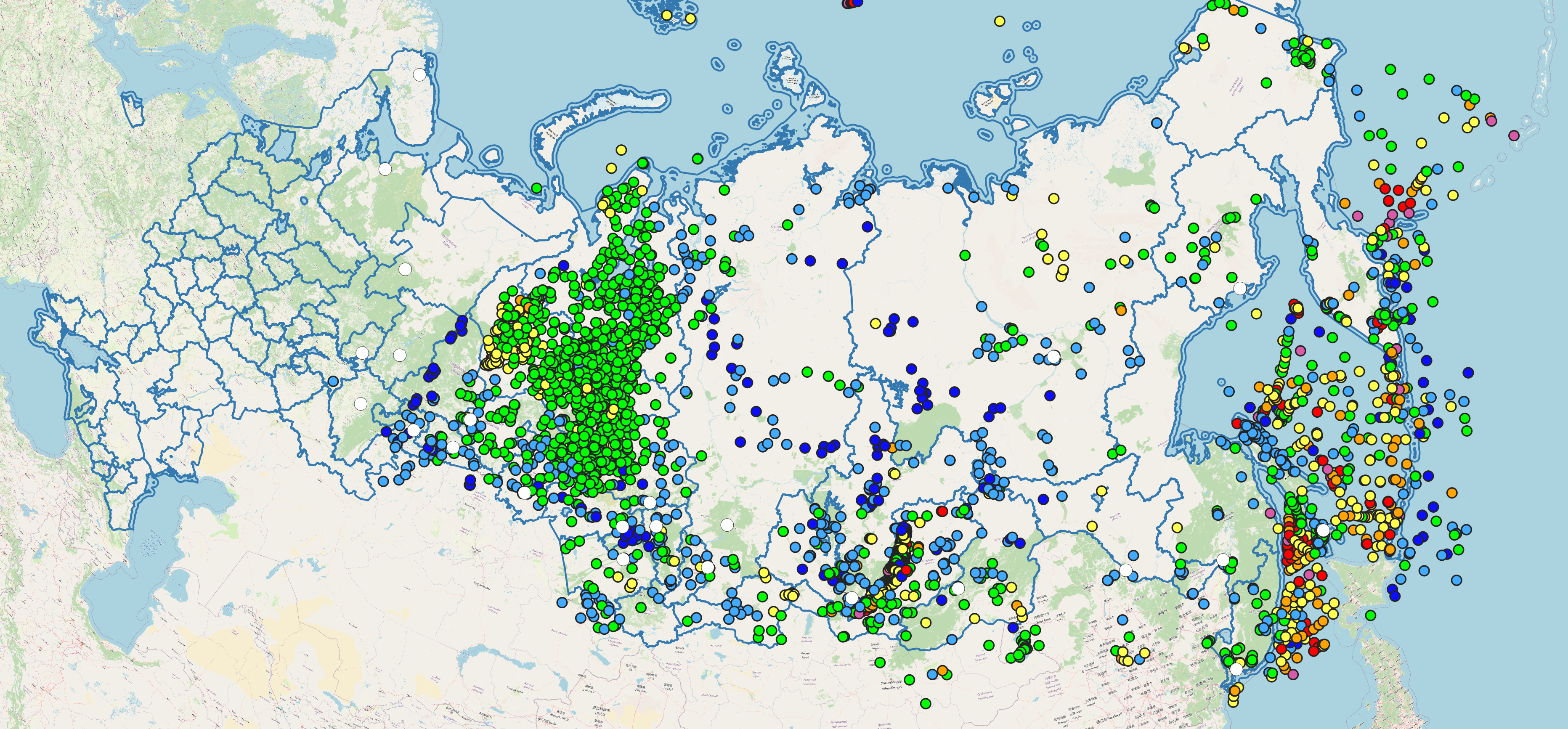
A characteristic feature of areas of active tectonogenesis is high seismic activity. During the instrumental period of observation, it is precisely here that the most destructive earthquakes have occurred, including the Crimean (1927), Fuyun (1938), Ashgabat (1948), Racha (1991), Neftegorsk (1995), Sichuan (2008), Tuva (2011), Turkish (2023) earthquakes, and others. Such events, while causing significant socio-economic damage, simultaneously stimulate the development of scientific directions aimed at identifying and assessing the characteristics of earthquake source zones.
The development and formalization of approaches to identifying earthquake source zones is aimed at advancing the fundamental foundations of General Seismic Zonation maps. The study examines the possibility of identifying earthquake source zones with minimal subjective input. The research is based on open sources and data processing algorithms: digital elevation models, seismic catalogs, results of GNSS data processing, and earthquake focal mechanisms. A variant of seismic regionalization based on tectonic zonation is proposed. Methodologically, the relationship between morphometric characteristics of the relief and instrumental seismicity is shown at a quantitative level using the examples of the Greater Caucasus, Sakhalin, and the Altai-Sayan folded area. The use of fuzzy mathematics, which allows calculating the "neotectonic activity index (F)" based on multi-scale morphometric quantities (°, m, m2, m-1, etc.), makes it possible to identify seismically active areas, including those for moderate earthquakes (M ≥ 5.5). The correctness of the obtained models is verified using ROC analysis. Integrating the results of morphometric studies with calculated values of maximum horizontal stresses (Sh) allows the identification of earthquake source zones. The estimation of Mmax within earthquake source zones is based on empirical relationships that use the length of the active fault.
Using the results of structural-geomorphological analysis, the degree of tectonic fragmentation of the upper part of the lithosphere was assessed based on the specific length of lineaments. A relationship was established between the values of specific lineament length, and disjunctive and plicative structures. At a quantitative level, a high (according to the Chaddock scale) confinement of active faults to gradient zones of specific lineament length has been proven. This provides a basis for using horizontal and vertical slices of the tectonic fragmentation field to identify potentially active faults, which are traced over the area by the distribution of gradients at a depth slice of 10 km. Positive values of specific lineament length correspond to areas of local uplifts (at shallow depths – up to 20 km), while at greater depths (more than 20 km), regional uplifts are identified.